Beyond the Skies: Uncovering the Unusual Capabilities of Modern Drones
Discover how modern drones are revolutionizing geoinformatics, agriculture, emergency response, and more. From mapping terrains to delivering critical supplies, these aerial marvels are transforming industries and addressing global challenges. Dive into the fascinating world of drones and their groundbreaking capabilities by reading the full blog.
GEOINFORMATICS
Dr Mahesha BR Pandit
2/20/20243 min read


Beyond the Skies: Uncovering the Unusual Capabilities of Modern Drones
In recent years, drones have taken to the skies with remarkable versatility, carving out an indispensable niche in countless industries. These devices, once the domain of hobbyists and tech enthusiasts, are now essential tools with capabilities that extend far beyond mere photography and videography. Modern drones represent a fusion of advanced technology and ingenuity, pushing the boundaries of what machines can achieve in the air.
Transforming Geoinformatics
Drones have emerged as powerful instruments in the field of geoinformatics, revolutionizing the way spatial data is collected, analyzed, and applied. Equipped with advanced sensors and cameras, drones can capture high-resolution imagery and create detailed topographic maps with unprecedented accuracy. Their ability to traverse difficult terrains and cover large areas makes them indispensable for surveying and mapping projects.
Remote sensing is one of the key applications where drones excel. By deploying multispectral and thermal sensors, they can collect data critical for understanding land use patterns, monitoring environmental changes, and assessing natural disasters. These capabilities are enhancing urban planning, disaster management, and resource allocation, providing geoinformatics professionals with tools to make informed decisions based on real-time data.
Aerial Innovators in Agriculture
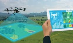
Farmers have found an unlikely ally in drones, which are redefining agricultural practices in extraordinary ways. These aerial tools provide real-time insights into crop health, soil quality, and irrigation patterns. Equipped with specialized sensors, drones can scan vast fields, identifying areas that require attention, whether due to pests or inadequate nutrients. This targeted approach not only improves efficiency but also reduces waste, making farming more sustainable and profitable.
Drones are even taking the lead in planting seeds and distributing fertilizers. With precise navigation and controlled dispersion mechanisms, they cover large areas faster than traditional methods. Their ability to perform these tasks autonomously frees farmers to concentrate on other critical aspects of cultivation.
Revolutionizing Emergency Response
When disaster strikes, the speed and flexibility of drones become invaluable. Emergency responders are deploying them to assess damage, locate survivors, and deliver critical supplies to areas that are otherwise unreachable. During wildfires, drones equipped with thermal cameras map out hotspots, aiding firefighters in their battle against the flames.
Search and rescue operations have also been transformed. With night-vision cameras and GPS capabilities, drones can scour terrains far more efficiently than ground teams. In scenarios where every second counts, their ability to relay live footage and pinpoint locations can make the difference between life and death.
Precision in Industrial Inspections
Industries reliant on infrastructure, such as oil and gas, telecommunications, and construction, have embraced drones for inspections. Traditionally, these tasks involved significant time, expense, and human risk, requiring workers to scale heights or navigate hazardous environments. Now, drones equipped with high-resolution cameras and sensors perform these inspections with unmatched accuracy and speed.
For example, energy companies use drones to monitor power lines, wind turbines, and pipelines. By identifying wear and tear or potential failures early, these devices help prevent costly repairs and downtime. In construction, drones create detailed site maps and track project progress, enabling teams to make informed decisions without stepping onto the site.
The Art of Delivery and Transportation
The notion of using drones for delivery has progressed from a futuristic idea to an operational reality. Companies are exploring how drones can transport goods, medical supplies, and even food. These airborne couriers navigate urban landscapes with ease, bypassing traffic and reducing delivery times significantly. In remote or disaster-affected regions, drones are bridging logistical gaps, bringing vital resources to communities in need.
While challenges such as regulatory approval and air traffic management remain, the progress made in this domain hints at a future where drones become a common sight in urban skies, zipping through the air with precision and purpose.
A New Perspective in Environmental Conservation
Drones are proving to be allies in the fight to protect the planet. Conservationists are deploying them to monitor endangered species, track illegal activities like poaching, and map out deforestation patterns. Their ability to cover large and often inaccessible areas provides researchers with crucial data that was previously difficult to obtain.
In marine environments, drones equipped with specialized sensors are being used to monitor coral reefs and track the movement of marine life. The insights gathered are helping scientists understand ecological changes and implement strategies to safeguard biodiversity.
The Challenges Ahead
Despite their many capabilities, drones face hurdles that require attention. Privacy concerns, safety regulations, and airspace management are critical issues that need thoughtful solutions. The rapid advancement of drone technology calls for equally progressive policies that balance innovation with public safety and ethical considerations.
As technology evolves, the possibilities for drones seem limitless. They are no longer just tools that fly—they are instruments of change, offering new perspectives and solving complex problems with unparalleled efficiency. From transforming geoinformatics to protecting the environment, drones are proving that the skies are not the limit but the beginning of what they can achieve.
Image Courtesy
Featured Image: Altigator (https://altigator.com/en/geographic-information-system-gis/)
Image at the top of this blog post: Santa Ana College (https://sac.edu/AcademicProgs/Business/Drones/Pages/drones-mapping.aspx)